
Object Record
Images
Metadata
Object ID |
XX-0389 |
Object Name |
Map |
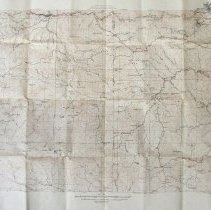
Description |
"Map of State of Colorado, Edition of 1924"; white rectangular paper map with black printing; shows the ranches, camps, schools, and major and secondary routes; "William E. Sweet, Governor, M.C. Hinderlider, State Engineer, Countour Map, Denver Mountain Parks, Edition of 1924, Topography by H.H. Hodgeson, Frank Tweedy, Max J. Gleissner, W.S. Beames, and F.D. Kramer. Surveyed in 1903 and 1923"; see color photographic image in accession file. |
Date |
1924 |
Caption |
XX-0389, "Map of State of Colorado, Edition of 1924" |